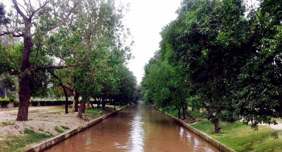
LAHORE – NESPAK has completed the geo-tagging of trees across a 22.5-kilometre stretch of Lahore Canal — the first large-scale digital mapping of urban green cover ever undertaken in the country.
It was stated by Mr. Zargham Eshaq Khan, Managing Director of NESPAK, here on Thursday.
The effort is part of the upcoming Lahore Yellow Line Project, being launched by the Punjab government. The initiative involved the precise identification of each tree using GPS-enabled surveying equipment, with coordinates and tree-specific metadata integrated into a centralised GIS database.
This structured dataset enables spatial analysis, supports condition monitoring, and provides a critical decision-making tool for authorities, urban foresters, and environmental planners.
Strategically located, the Lahore Canal greenbelt functions as one of Lahore’s primary ecological corridors, mitigating air pollution, regulating microclimate, and enhancing urban biodiversity. NESPAK’s intervention equips this corridor with a robust digital inventory, facilitating data-backed management without disrupting the integrity of the ecosystem.
More than a technological deliverable, this initiative reflects NESPAK’s expanding role in climate-conscious infrastructure development. The ability to digitise tree health baselines, plan plantations using geospatial intelligence, and identify encroachments or illegal removals sets a modern precedent for managing urban green assets with accountability.
This milestone signals a forward-thinking alignment with global urban sustainability practices. NESPAK continues to lead with precision and purpose — integrating engineering excellence with environmental foresight to address the evolving needs of Pakistan’s cities.


